Over Bridge
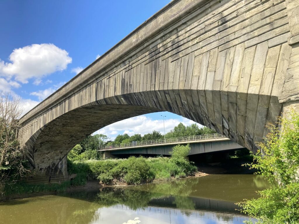
Over Bridge was the southernmost road crossing of the River Severn and the last road bridge to be built before the Severn Crossings. It is a handsome single arch designed by Thomas Telford, who took inspiration from French Baroque architecture. The bridge is also famous for sinking 10 inches upon completion, a mistake Telford later regretted; however, it has stood the test of time.
Key info
| Location | Horseshoe Dr, Highnam, GL2 8BZ |
| County | Gloucestershire |
| Completed | 1829 |
| Engineer | Thomas Telford |
| Maintained by | English Heritage |
| Heritage category | Scheduled Monument |
Visiting guide
Open 24 / 7
Free entry
Free street parking
What can I expect when visiting Over Bridge?
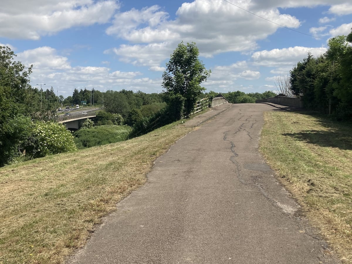
Walk from Horseshoe Drive up to its junction with the A40. There is a public footpath to the left that goes under the road. Head through and you will see the path to the bridge ahead through the gate. There is an information board that details the plan of the bridge and its foundations. As you look ahead, you’ll now see the original route of the A40 and its new bridge to the left.
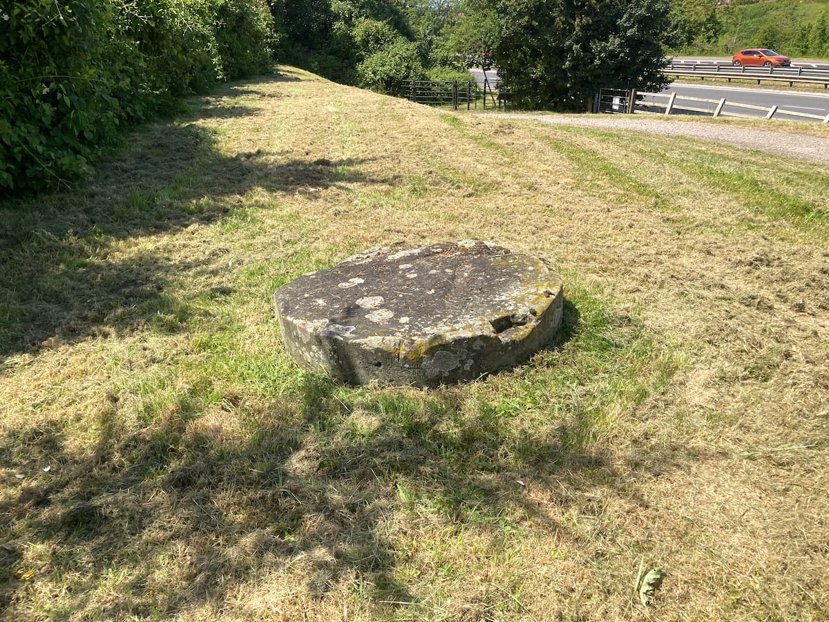
You will also see the remains of a column that most likely supported a gate for the original road. The construction of the new A40 has virtually obliterated all traces of this junction so a good imagination is essential.
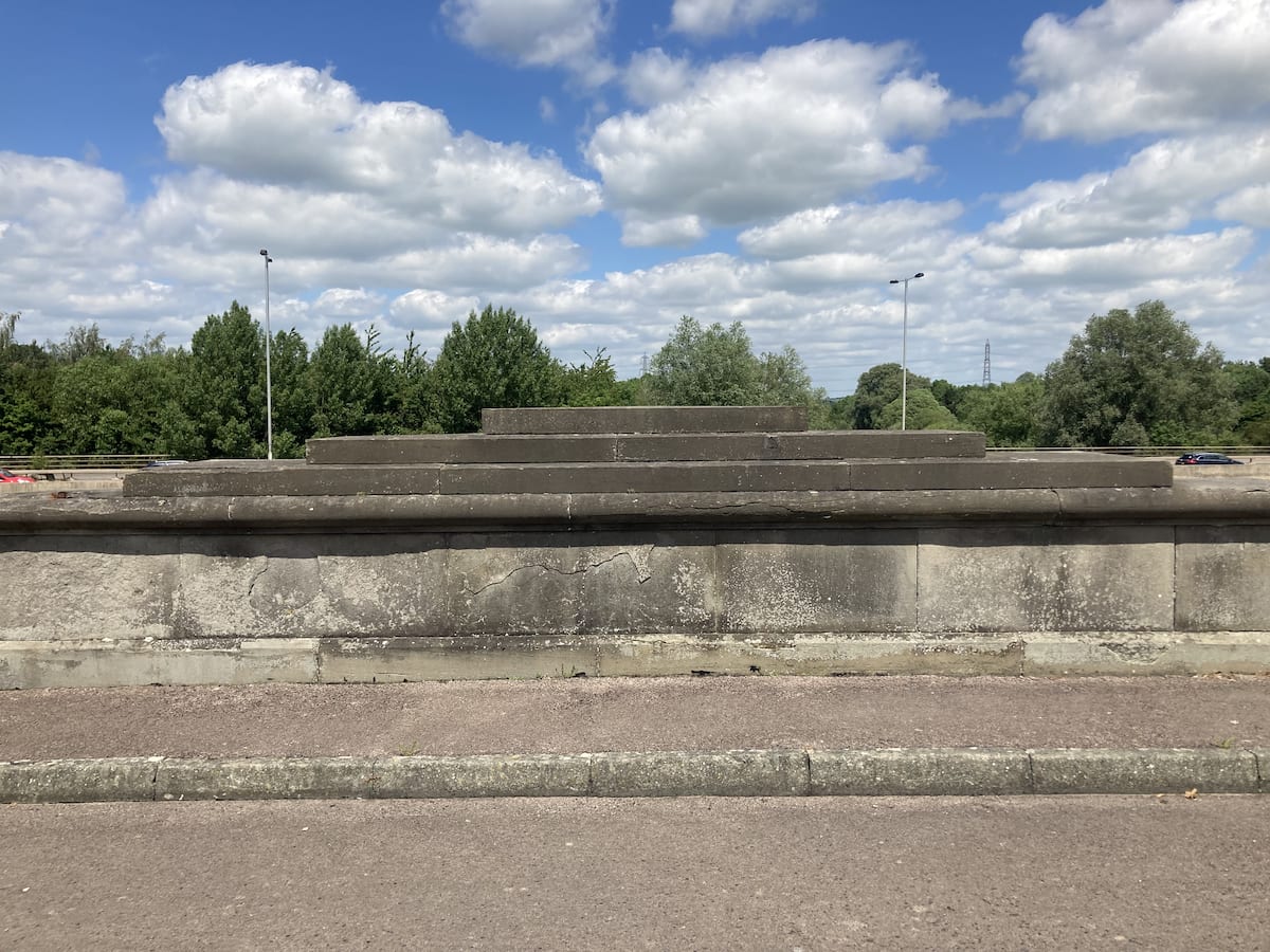
As you walk onto the bridge, you can appreciate the detail of the masonry, particularly the pyramidal capstones.
Walk across the bridge, down the spiral path where you should see a path through the vegetation to the flood arch.
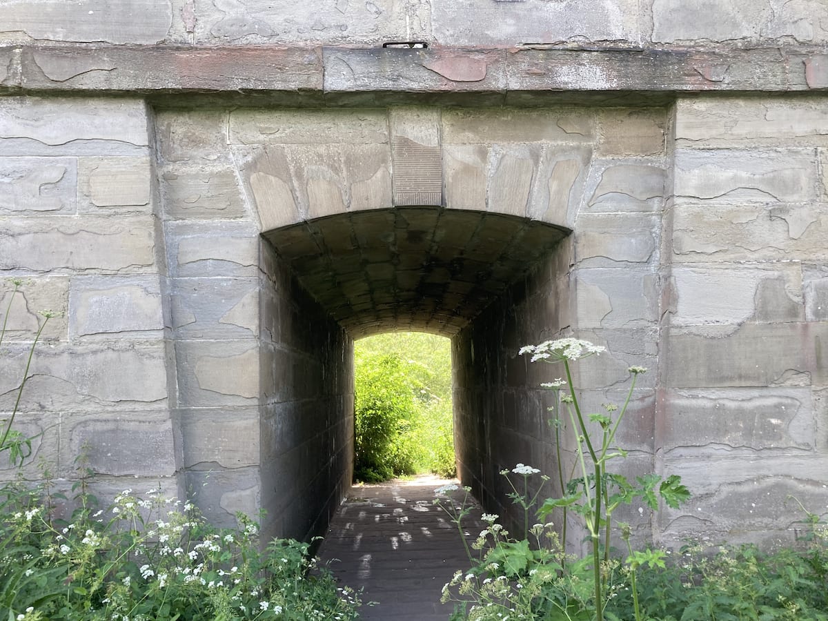
Walk under the arch. Here you will get the best view of the bridge and its voussoirs, or external arch stones, that were designed to give the bridge a funnel-like appearance. The purpose of this feature is to reduce the resistance of floodwater and tidewater as it passes under the bridge (the Severn is tidal at this point).
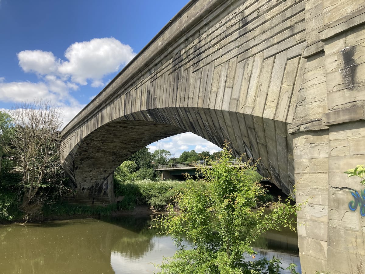
Look up to see a closer view of the abutment with its baroque-inspired decorative masonry.

You know have the option to extend your visit with a walk through Alney Island, it’s a beautiful nature reserve with cuckoos and other birds. You may wish to visit Llanthony Lock, which is about a 15-minute walk.
How long does it take to see Over Bridge?
It will take you around 10 minutes to see the bridge from above and walk underneath it’s flood arches for views of the side.
Is Over Bridge suitable for a picnic?
Alney Island to the east of Over Bridge is a nature reserve with plenty of spots for a picnic. Head to the southwest corner of the island where it is most peaceful away from the dual carriageways.
How do I get to Over Bridge?
There is free parking opposite the A40 on Horseshoe Drive. If you wish to get public transport in Gloucester, Over Bridge is a 30-minute walk from Gloucester Cross.
History of Over Bridge
Background
There has been a crossing at this point of the Severn since the Romans, the remains of a Roman camp are located just off Horseshoe Drive by the A40. A bridge had existed at Over since the 13th century and had been rebuilt multiple times over the years.
The bridge before Telford consisted of eight arches of varying widths, the largest being 24 ft (7.3 m). The bridge had been designed to carry the roadway and its many piers and low, narrow arches were inconvenient obstructions to river navigation. At high tides and during floods, the arches were either impassable or extremely dangerous; and as road traffic increased, the narrowness of the roadway became inconvenient for carriages [1].
Chronology
1825 – The magistrates of Gloucestershire commissioned Thomas Telford to design a new bridge to replace its predecessor. Having recently completed a design for the Mythe Bridge, a 170 ft single span arch made out of cast iron, Telford was convinced a similar design would be sufficient; however, the magistrates gave preference to a design using stone, which he obliged [1].
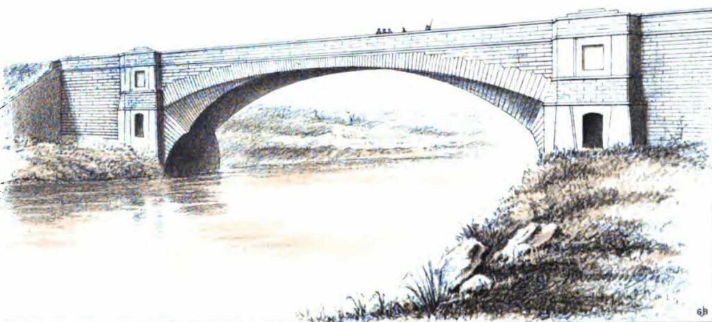
Telford used a design that had been delivered in 1768 by an eminent French architect, Jean-Rodolphe Perronet, on a bridge that crossed the Seine at Neuilly. In the years leading up to the French Revolution, Perronet was doing in stone what Telford had been doing in iron, building flatter arches, with narrow arch rings and more delicate piers [2].
The body of the arch is an ellipse with a chord line of 150 ft and a rise of 35 ft, but the voussoirs, or external arch stones, were set to segments on the same chord with a rise of only 13 ft. The effect of this gives the arch a funnel-like shape, which would offer less resistance to floodwater [3].
1826 – Construction begins in July with John Cargill as the contractor. He had great experience and respectability who had for upwards of twenty years, been employed upon public works under Telford’s direction.
The riverside meadows were excavated until, at depths of 27 ft on the west bank and 33 ft on the east, a bed of natural gravel was encountered. One row of piles was used to construct a cofferdam to keep the earth around the excavation on the solid bank.
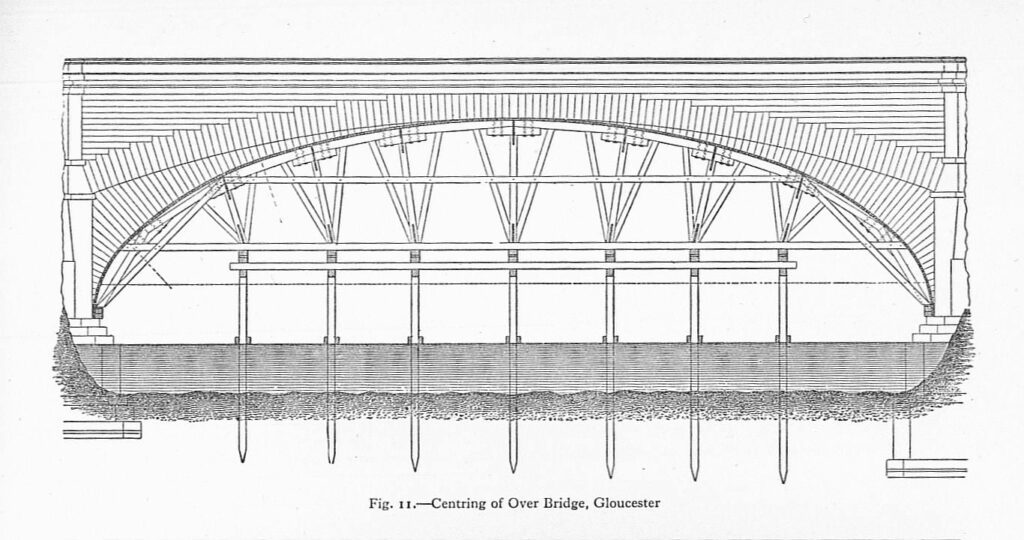
Rubble stone was laid on the natural gravel and then great logs of Memel pine between 37 ft and 40 ft long topped with beech planking. This was the foundation platform for masonry. The internal stone was brought downriver from quarries at Highlyey and Alveley, six miles above Bewdley. The external stone came from the quarries of Coleford and Quitchurch in the Forest of Dean. A timber-frame or centring supports the stone arch as it is constructed until it is keyed [1].
1827 – A stonemason named Nelson working on the Over Bridge is arrested by police after being recognised as one of the ringleaders of the Gloucester Riots [4]. Three other workmen on the Over Bridge are also taken into custody and committed to trial. The riots occurred on the Westgate Bridge on the east side of Alney Island. Frustration had been stirred amongst the workmen who had to pay the toll every time they crossed the Westgate Bridge on foot to and from Gloucester and their worksite at Over. A riot broke out, which resulted in damage to the toll gate and house. Troops were called in by the city Magistrates to establish order. It appeared the workmen were instigated by others who wished for the toll to be removed, which had continued to be charged past its remit to raise money to pay for the construction of the causeway to Over. The toll for foot passengers was removed three weeks later [5].
1829 – The bridge is completed. When the centring was removed, the whole weight of the arch was left to press against the abutments, and its crown sunk about 2 inches. The bridge sank a further 8 inches following further depression of the eastern wing walls because the alluvial soil was soft. Telford later blames himself for suffering ill-judgement for leaving the foundations of the wing walls unsupported by piles and platforms. He writes his convincement that the arch would not have sunk more than 3 inches if he had foreseen this mistake and rectified it accordingly. The bridge and its approaches cost £43,500 (£4.38 million in 2020) [1].
1832 – Work to repair the damage is completed after two years [6]. Traffic is then turned across Over Bridge.
1836 – The demolition and removal of the old bridge are completed, two years after the contract was first made.
1857 – The subsidence of Over Bridge continued to give concern; work was carried out to restrict it from further movement [8].
1881 – Additional work was carried out again to address concerns over subsidence [9].
1966 – The Severn Bridge is opened at Aust; therefore, Over Bridge is no longer the southernmost crossing on the river (excluding ferries) [10].
1968 – Over Bridge becomes a Scheduled Ancient Monument [11].
1975 – The new A40 bridge is completed and traffic stops using Over Bridge [12]. The old Over Causeway is also demolished, which drastically changes the landscape of Alney Island. All these developments cut off Over Bridge from the road network. It now stands as an isolated monument.
Architecture and dimensions
The single arch of Over Bridge is an ellipse measuring 150 ft (45.72 m) on the chord-line, and 35 ft (10.66 m) rise, while the voussoirs (or external arch-stones), being in form of a segment, have the same chord with only 13 ft (4 m) rise [1]. The carriageway measures 17 ft with a footway of 4 ft on each side [12].
Sources
- Telford, T. (1838) in Rickman, J. (ed.) Life of Thomas Telford, Civil Engineer, Written by Himself. London: James and Luke G. Hansard and Sons.
- Burton, A. (2015) Thomas Telford Master Builder of Roads and Canals. Barnsley: Pen & Sword Transport.
- Rolt, L. T. C. (1986) Thomas Telford. Harmondsworth: Penguin Books Ltd.
- (1827) ‘Gloucester Riots’, London Evening Standard, 9 October, p. 3.
- (1827) ‘Riots at Gloucester’, London Courier and Evening Gazette, 6 October, p. 4.
- ‘Thomas Telford, letters and reports, 1825-32, including preliminary report and specifications, 1826’, Gloucestershire Archives, Q/AB 3/3.
- ‘Gloucester: Highways and footpath diversions: papers extracted from Trinity sessions roll’, Gloucestershire Archives, Q/SRh/1834C/4.
- ‘Old Over Bridge’, Gloucestershire Archives, Q/AB/3/1.
- (1881) ‘Over Bridge’, Gloucester Citizen, 5 April, p. 4.
- Carradice, P. (2011) ‘The First Severn Bridge’, BBC. Available at: https://www.bbc.co.uk/blogs/waleshistory/2011/09/the_first_severn_bridge.html (Accessed: 28 June 2021).
- Historic England (2020) Over Bridge. Available at: https://historicengland.org.uk/listing/the-list/list-entry/1015873 (Accessed: 28 June 2021).
- Cragg, R. (1997) Civil Engineering Heritage Wales and West Central England. London: Thomas Telford Publishing.

 River Severn Locks & Weirs