Gloucester Docks
Gloucester Docks is a historic inland port located in the city of Gloucester, England. The docks were originally built in the early 19th century to accommodate the growing trade of the city, which was primarily focused on the export of timber and grain. The docks continued to expand over the next century, becoming one of the most important ports in the country for the import and export of goods. Today, the docks have been transformed into a vibrant cultural quarter, with a range of museums, restaurants, and shops. The docks are also home to a number of heritage boats and vessels, which are preserved as part of the city’s maritime history.

Key info
Visiting guide
Open 24 / 7 (excluding businesses & attractions)
Free entry (excluding attractions)
Paid car parks
What can I expect when visiting Gloucester Docks?
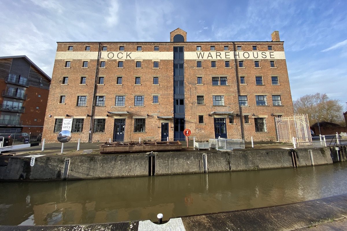
You can start your tour anywhere along the docks; however, we recommend starting on Gloucester Lock to the northwest. Originally two adjoining locks, it was replaced with one barge lock later on to open upriver routes for larger vessels as competition from the railways increased. Opposite you will see Lock Warehouse, notice the large windows. They date from the 1920s when the building was used for sack cleaning and repairs.
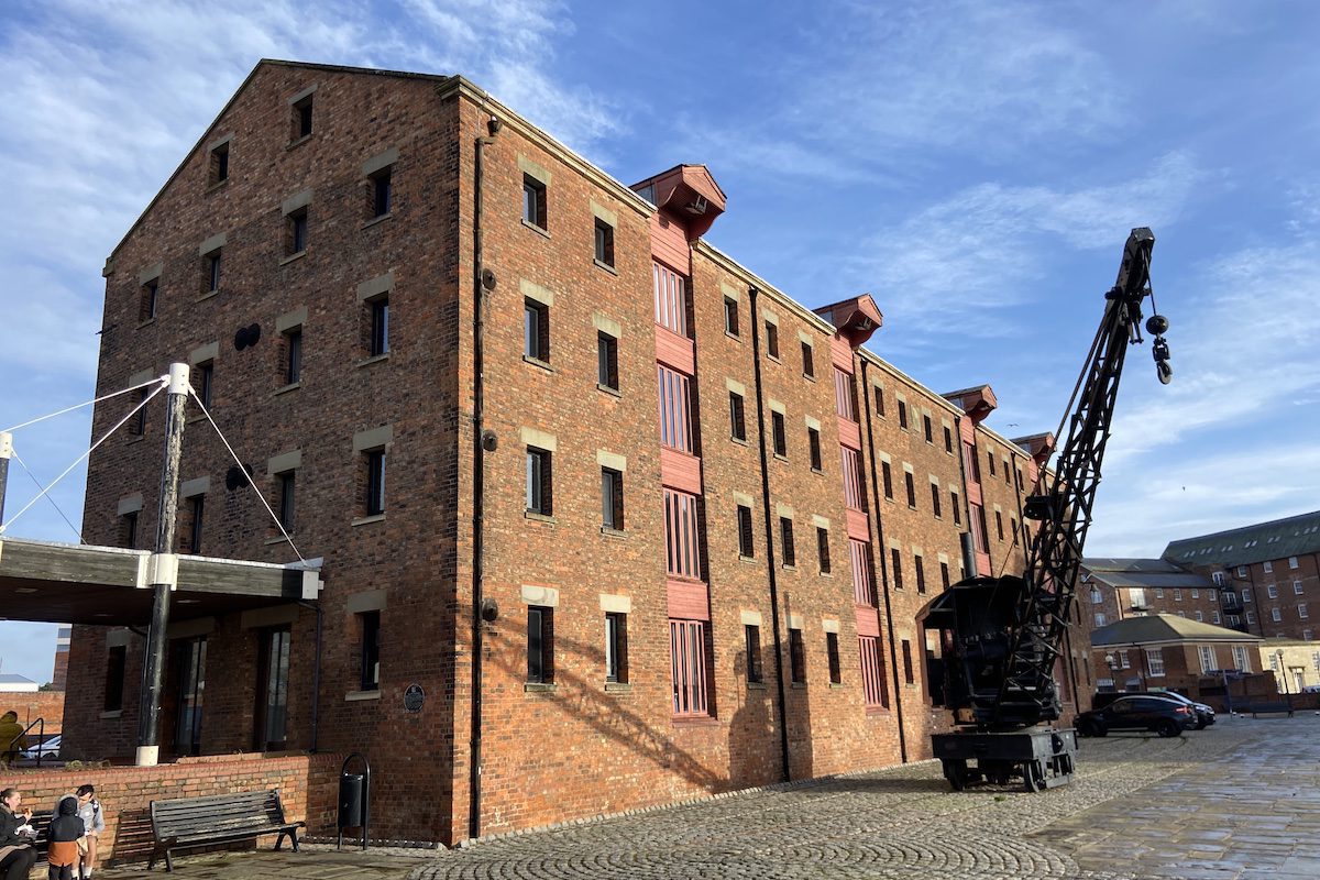
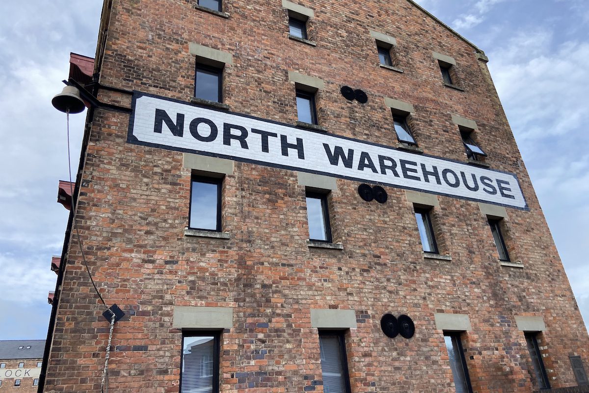
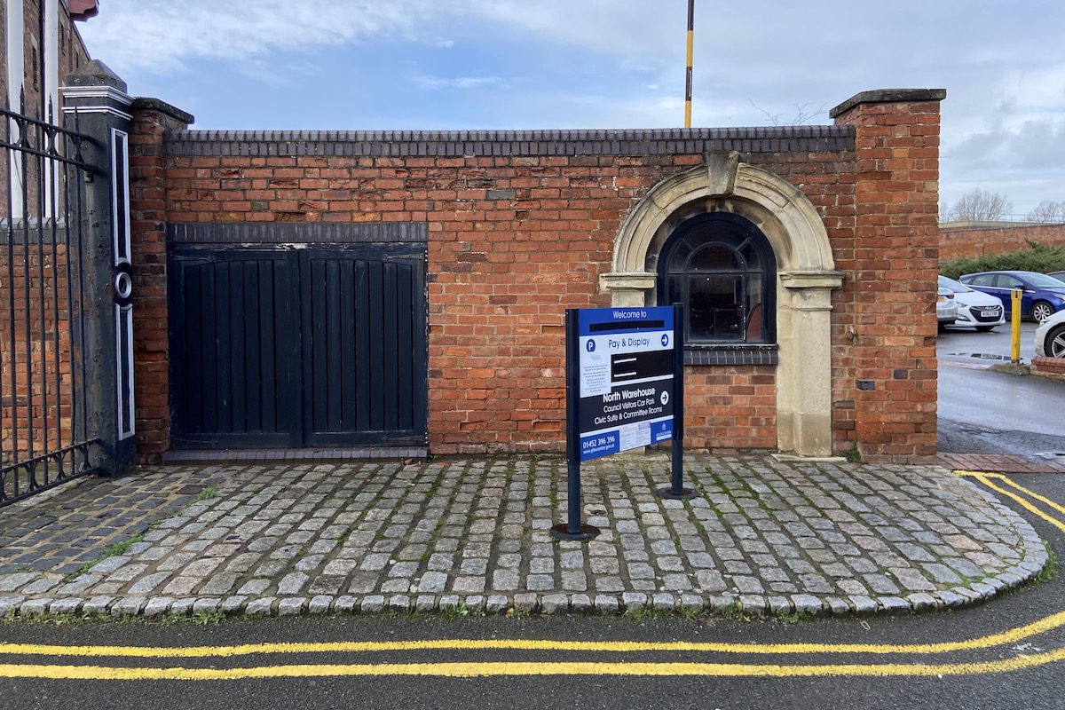
Turn around for a view of the North Warehouse, the first warehouse to be built which had eight storerooms that were originally rented to corn merchants and two basements used by wine importers. In the 20th century, the warehouse housed equipment for milling wholemeal flour. Notice the adjacent steam crane. It was manufactured in 1944 and could lift up to 5 tons on a single hook.
Walk east around the warehouse and look up for a glimpse of the Atlas Bell. It was manufactured in 1812 for The Atlas, which made several voyages to India and China for the East India Company. After the ship was broken up in 1832, the bell was used here for signalling start and finish times for the dockers. It was moved to Shepperdine in 1941 for use as a navigation aid in fog before returning to Gloucester in 1986.
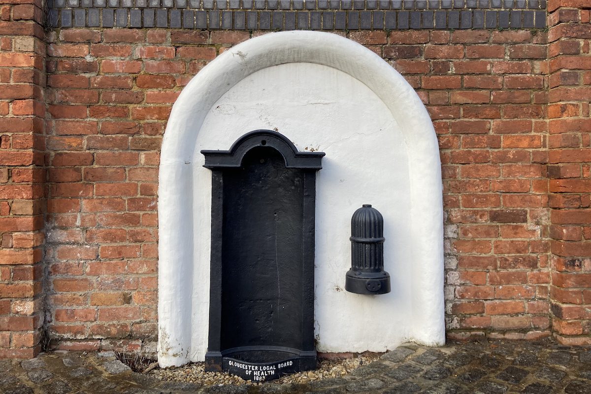
Turn around the corner where you will discover a water fountain commissioned in 1863 by the Gloucester Local Board of Health in response to a request from dock merchants to provide drinking water for the benefit of their workers. A fire hydrant is located to the right of the fountain.
Next to the fountain is the northern dock gatehouse.
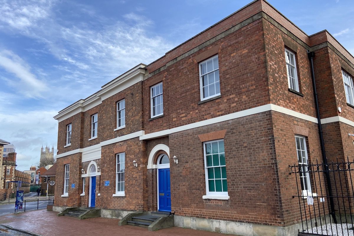
Opposite is the former offices of the Gloucester and Berkley Ship Canal Company, which also provided living accommodation for the company clerk. The building later became the office of the Gloucester Dock Company and after 1947, housed the British Waterways Board. It now functions as private offices.
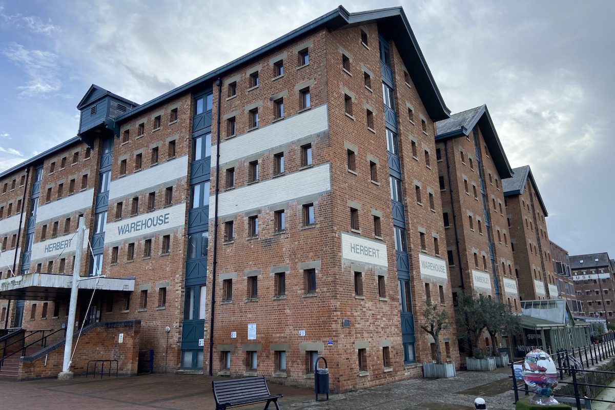
Opposite the offices are the Herbert, Kimberley, and Phillpotts warehouses that were constructed nearly 20 years after the docks opened to accommodate the growth in grain imports following the recent repeal of the corn laws. The warehouses were named after their occupants or owners.
Behind the dock offices is the former City Flour Mill with adjoining warehouse and office block. The mill was built in 1850 for Joseph and Jonah Hadley. Three years later, when a damaged crankshaft was delayed in transit, the brothers sued the carriers for loss of profits. The subsequent landmark case established the ‘foreseeability of damages’ rule in English Law, that is still applied in many countries globally.
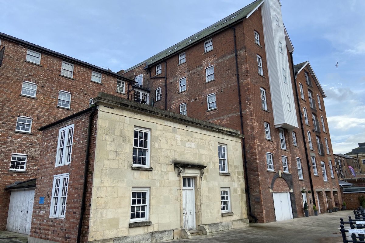
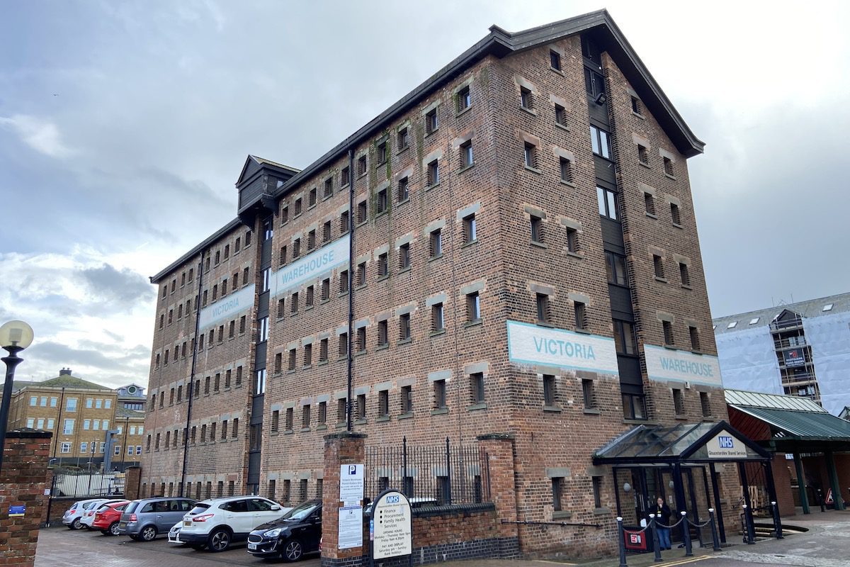
Opposite the mill is Victoria Warehouse dating from 1849 which now functions as a health clinic.
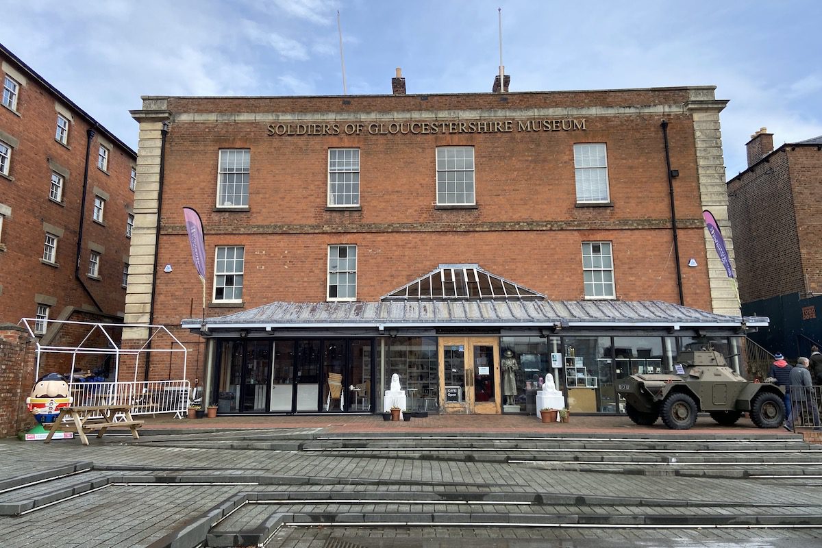
Opposite Victoria next to the former mill is the old customs and excise office, which would have recorded all the trade through the dock. The building now houses the Regiments of Gloucestershire Museum.
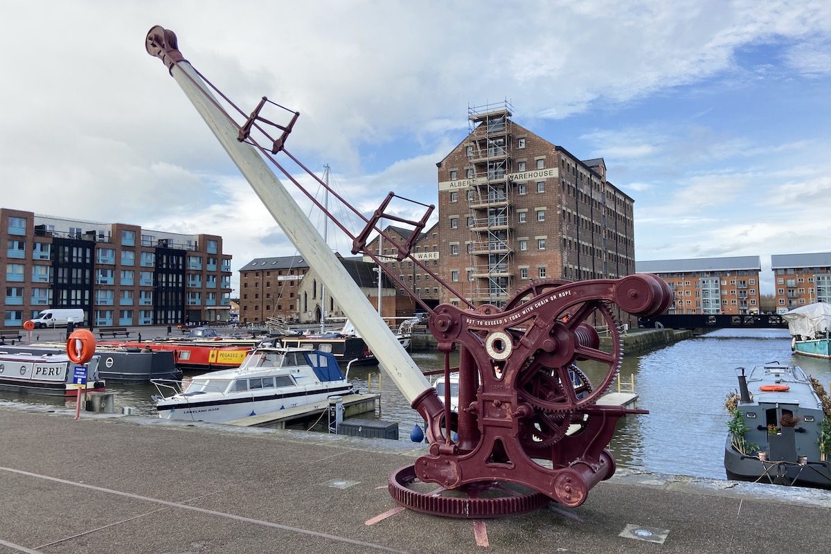
The museum faces the Victoria Basin, which was completed 22 years after the docks initially opened. Along the basin is a crane dating from 1902.
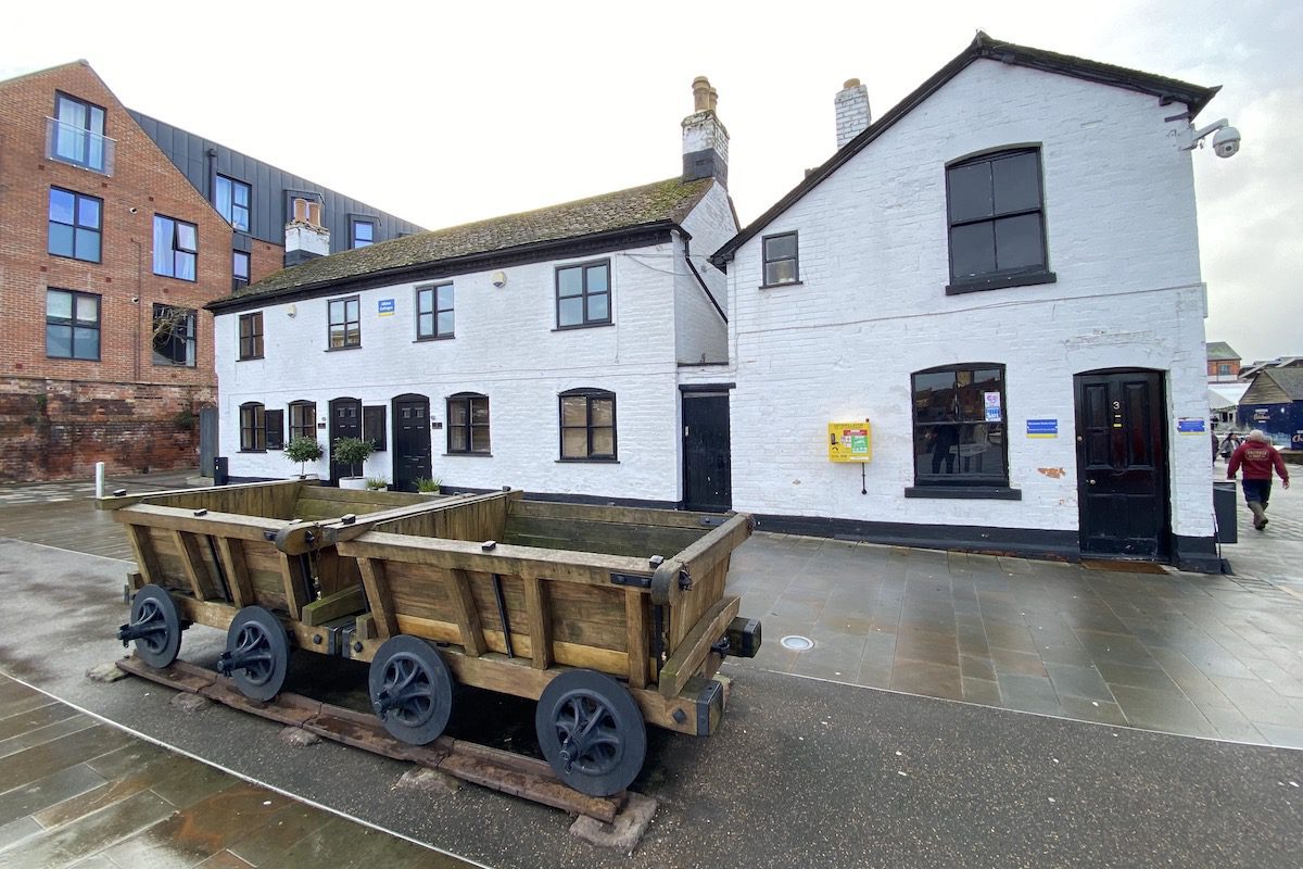
At the end of the basin stands the Albion Cottages, which would have housed workers. In front is a replica of Gloucestershire’s first railway project, which was a horse-drawn tramroad that connected the docks with Cheltenham. It mainly carried coal and roadstone and also served as a link between the docks and later, a railway freight yard in town.
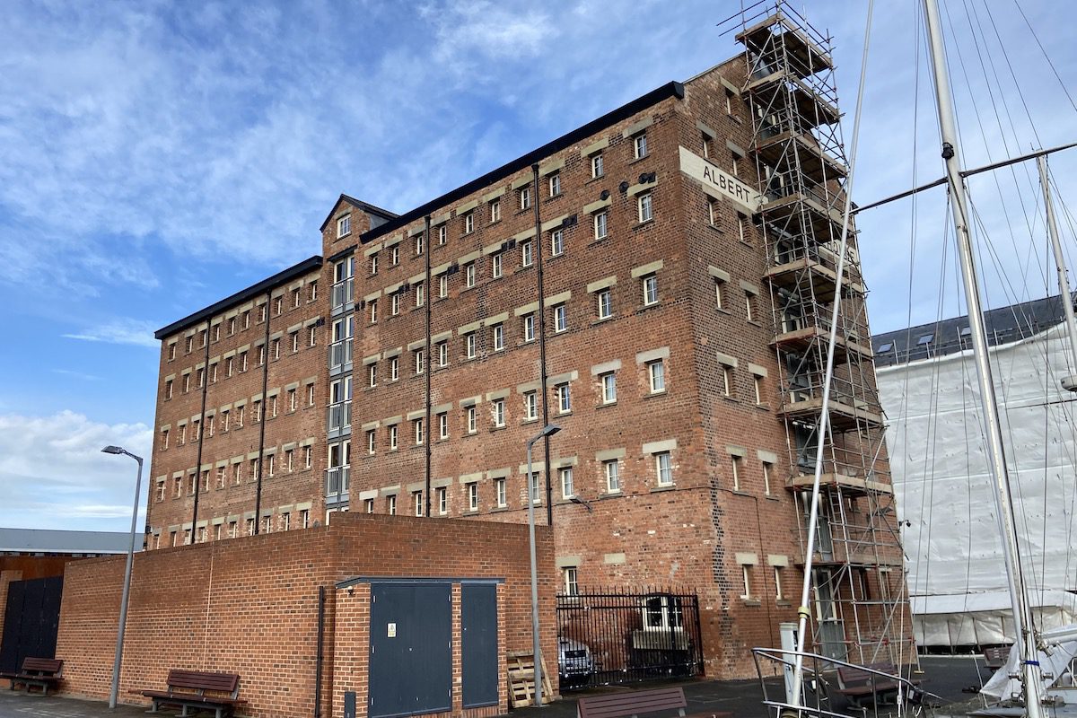
Continue walking around the Victoria Basin for a view of the Albert Warehouse, which was constructed at the peak of the corn trade. It later served as a flour mill.
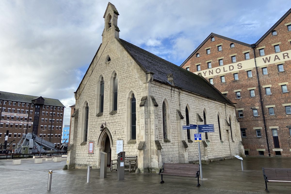
Opposite Albert is the Mariner’s Church, which was once frequented by seamen from many nations who travelled to Gloucester on cargo ships. This included France, Italy, Scandinavia, Netherlands, Germany and escaped slaves from the USA. The chaplain organised services in foreign languages including Welsh, Hindustani, and Chinese.
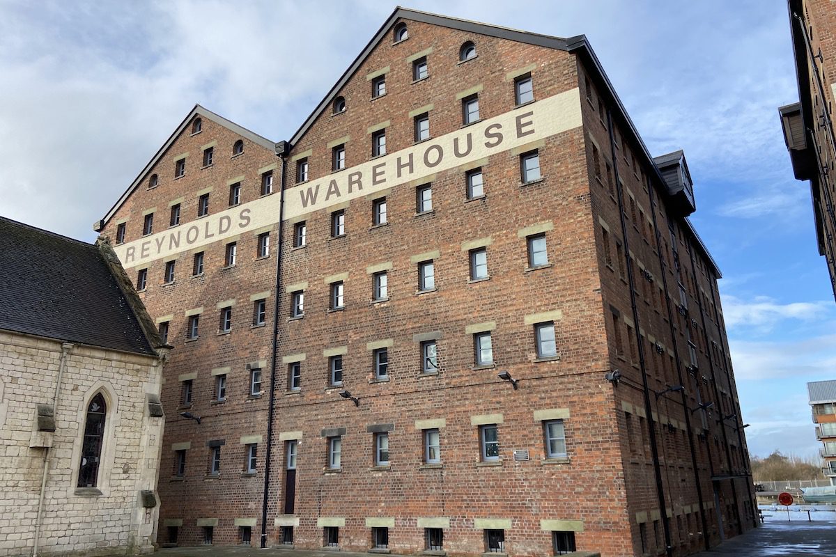
Behind the church is the Double Reynolds Warehouse (originally called Sturges Warehouse) constructed for the largest corn merchant of the day J & C Sturge who were estimated to have controlled around half of Gloucester’s imported corn. It became a storage for bagging flour from the nearby mills in Albert Warehouse.
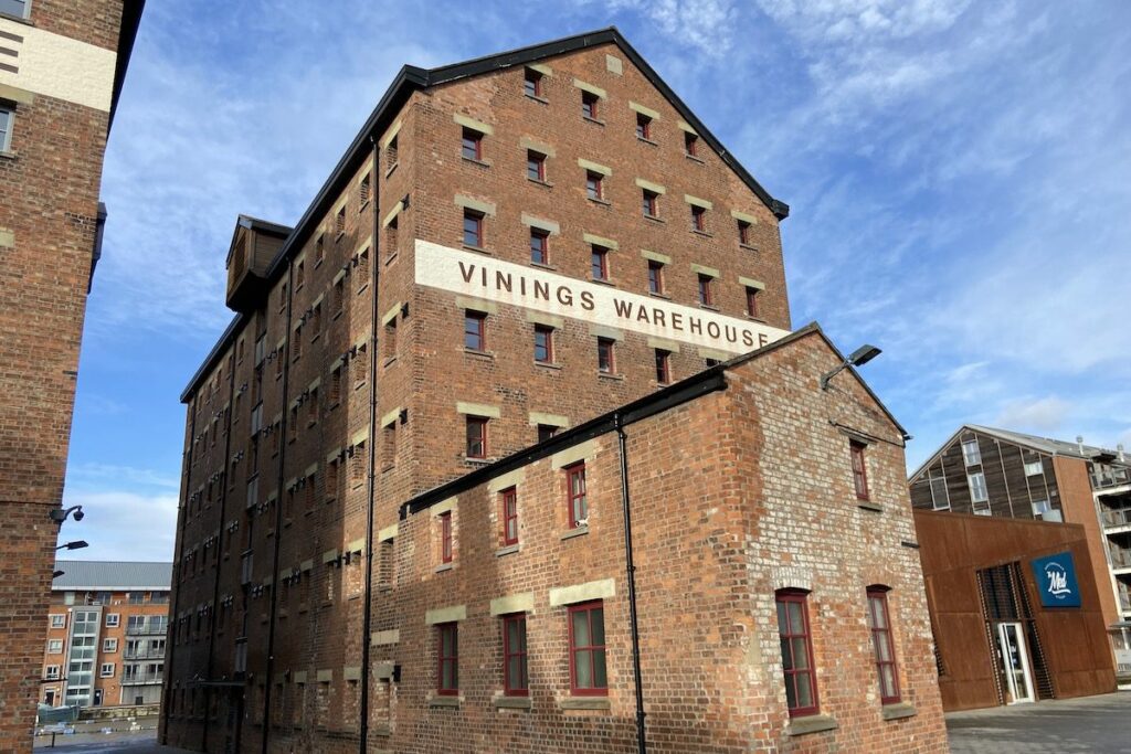
Next to Reynolds is Vinings Warehouse constructed for the Bristol-based corn merchants Charles Vining & Sons. This warehouse originally had a ground floor with double the height that was used by a firm of iron merchants. In the 20th century, the building stored corn for the mills in Albert Warehouse.
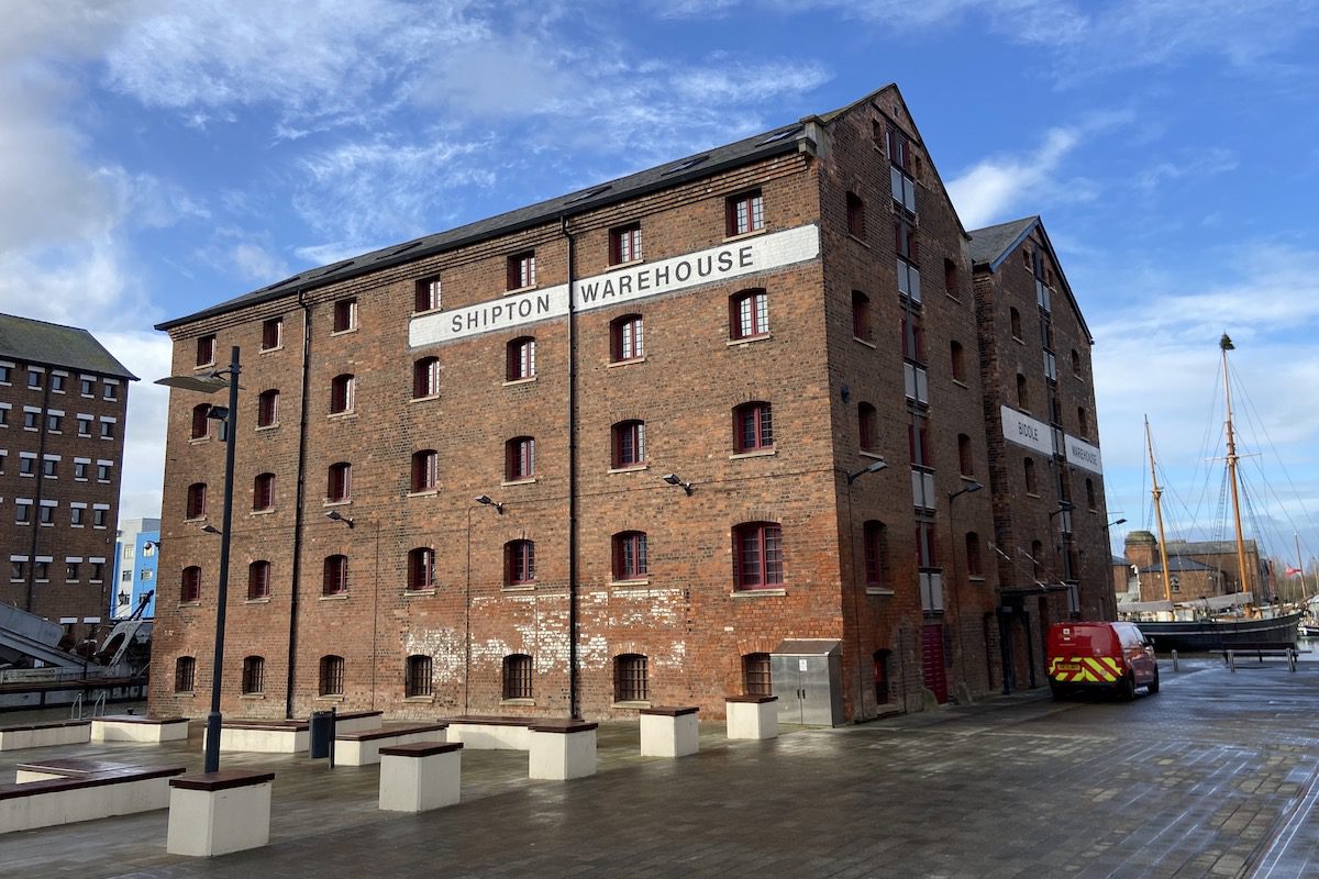
Behind Reynolds is the earlier Shipton and Biddle warehouses from 1830 used by millers, timber merchants and corn traders.
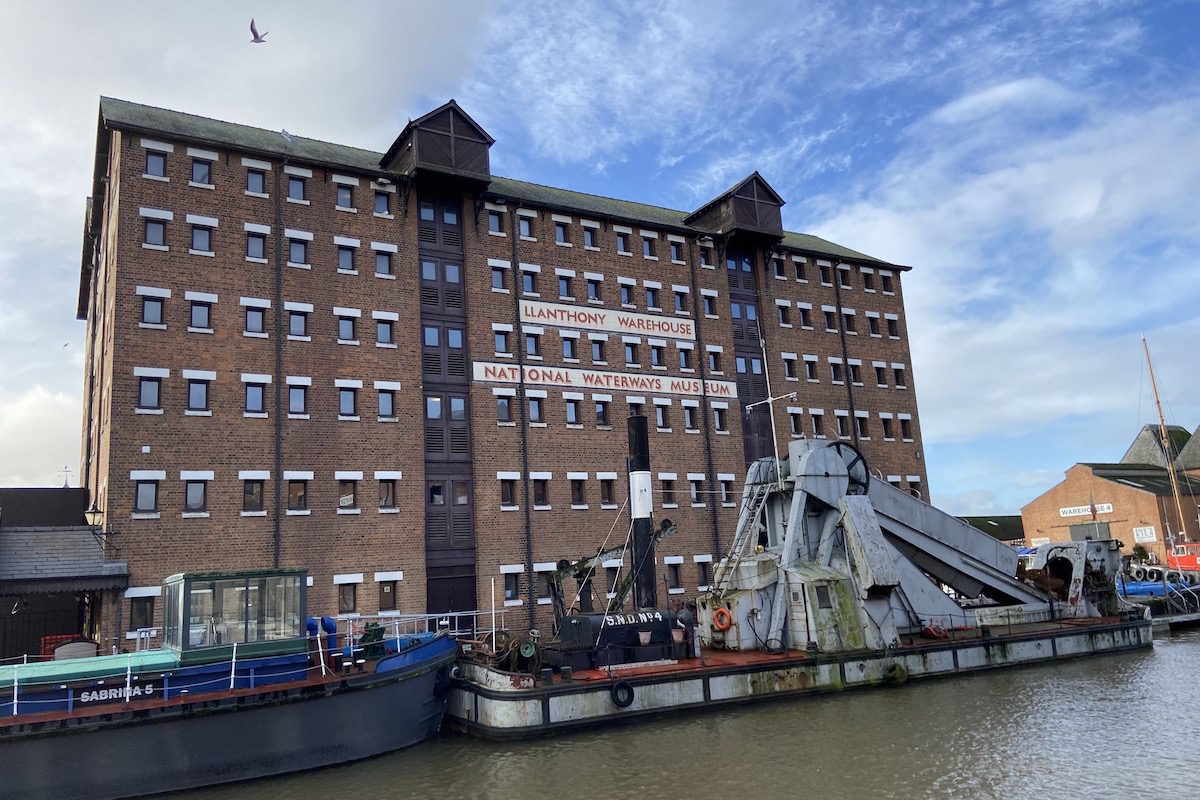
Behind Shipton and Biddle opposite the Barge Arm is Llanthony Warehouse, the last to be constructed on the docks before the site was regenerated. It was used by corn merchants and now houses the National Waterways Museum, which is worth a visit.
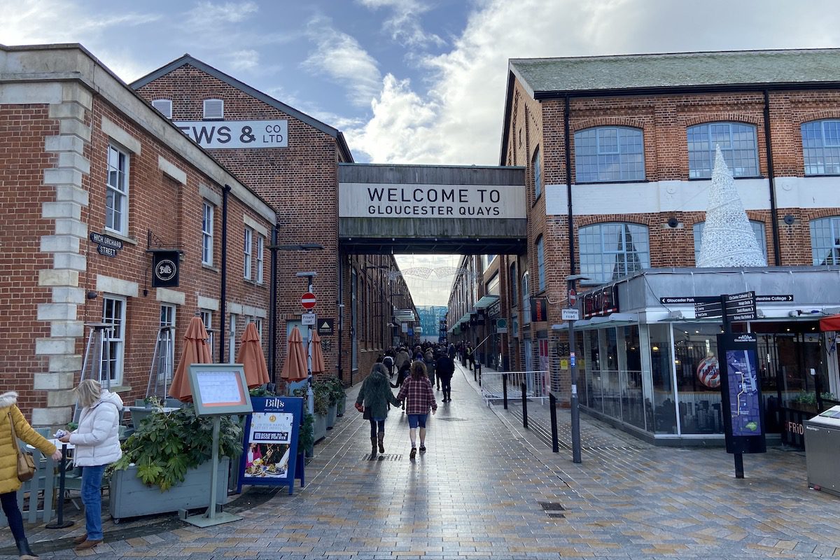
Walk around the Barge Arm and you will arrive at the entrance to Gloucester Quays, a shopping complex that on the site of the Atlas Works used by the engineering firm Fielding and Platt. It produced Britain’s first vacuum cleaner in 1902, pioneered the manufacture of hydraulic machinery, and made the aluminium plate stretcher that produced parts for Concorde in 1963.
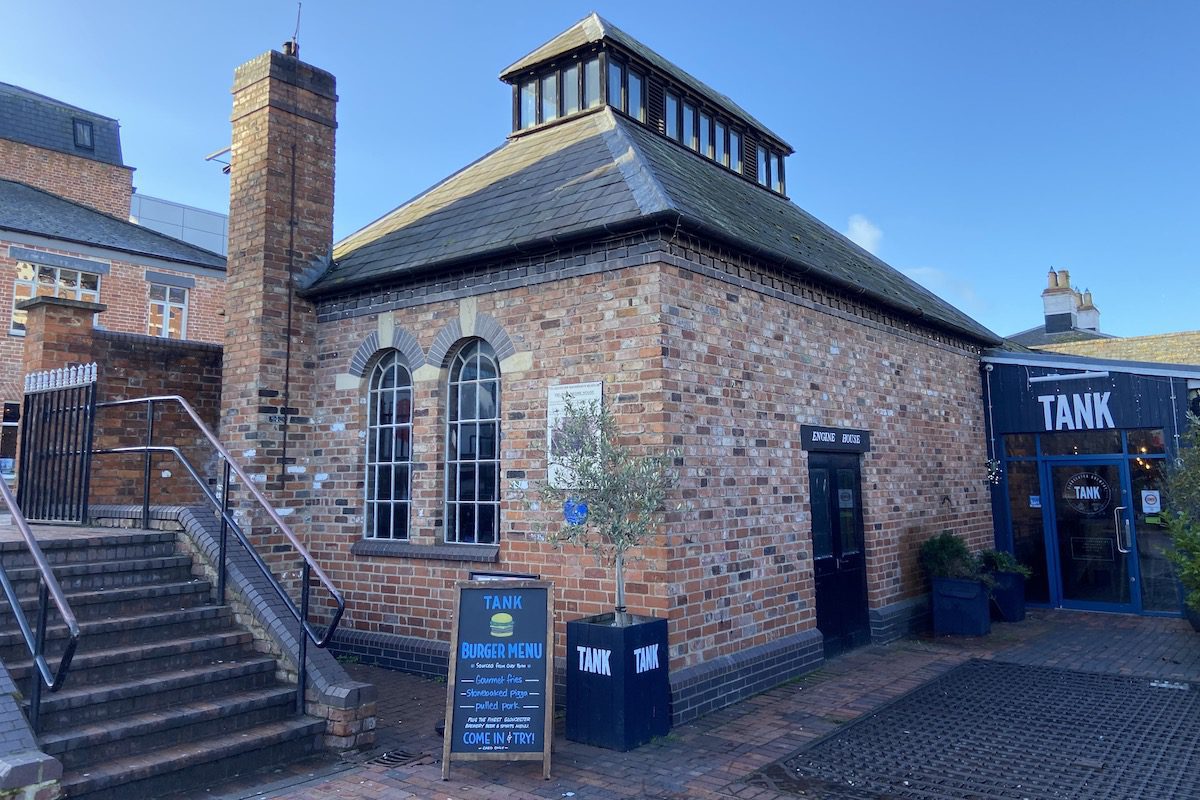
Head west along Llanthony Road and you will see the old engine house that contains a working Fielding oil engine from 1929. It originally ran the belts and pulleys of a machine shop near Cirencester before running as a generator during World War II. It was last used in 1974 during the power cuts caused by the miners’ strikes. Notice the old weighing machine next to the engine house, it has a capacity of up to 15 tons.
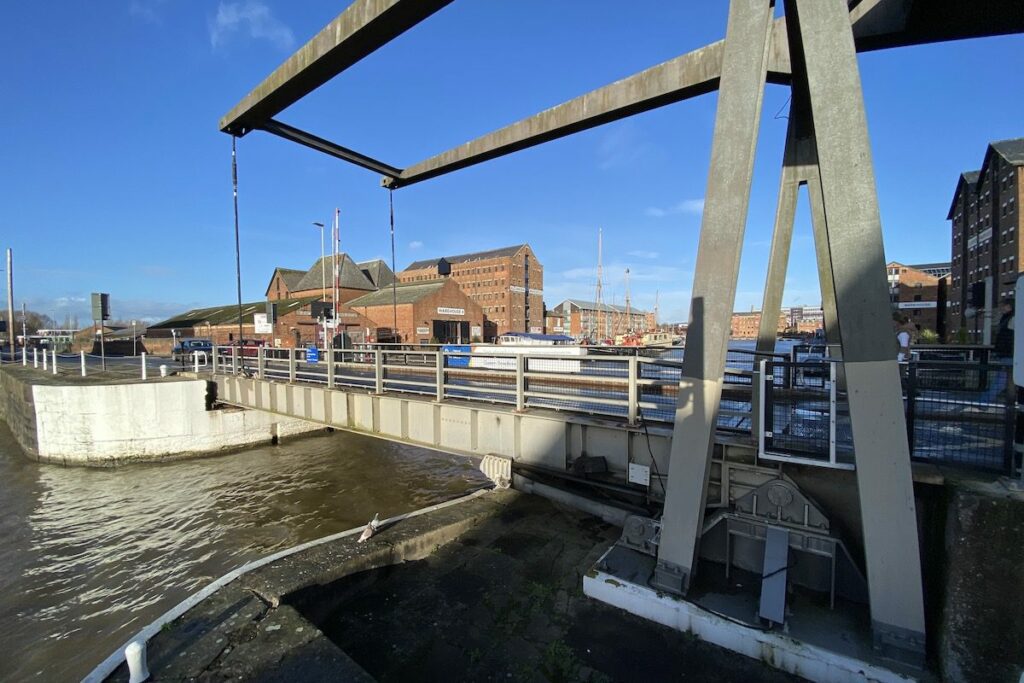
Continue west along Llanthony Road to the Llanthony Lift Bridge that carries the road across the Gloucester & Sharpness Canal (formerly the Gloucester & Berkley Ship Canal) as it enters the dock. The canal was constructed for the safe passage of ships from the Severn Estuary up to the River Severn avoiding a meandering section of the estuary that was treacherous to navigate. This is the very reason why Gloucester Docks was constructed. This is the third bridge on this site replacing two swing predecessors first made of wood then iron.
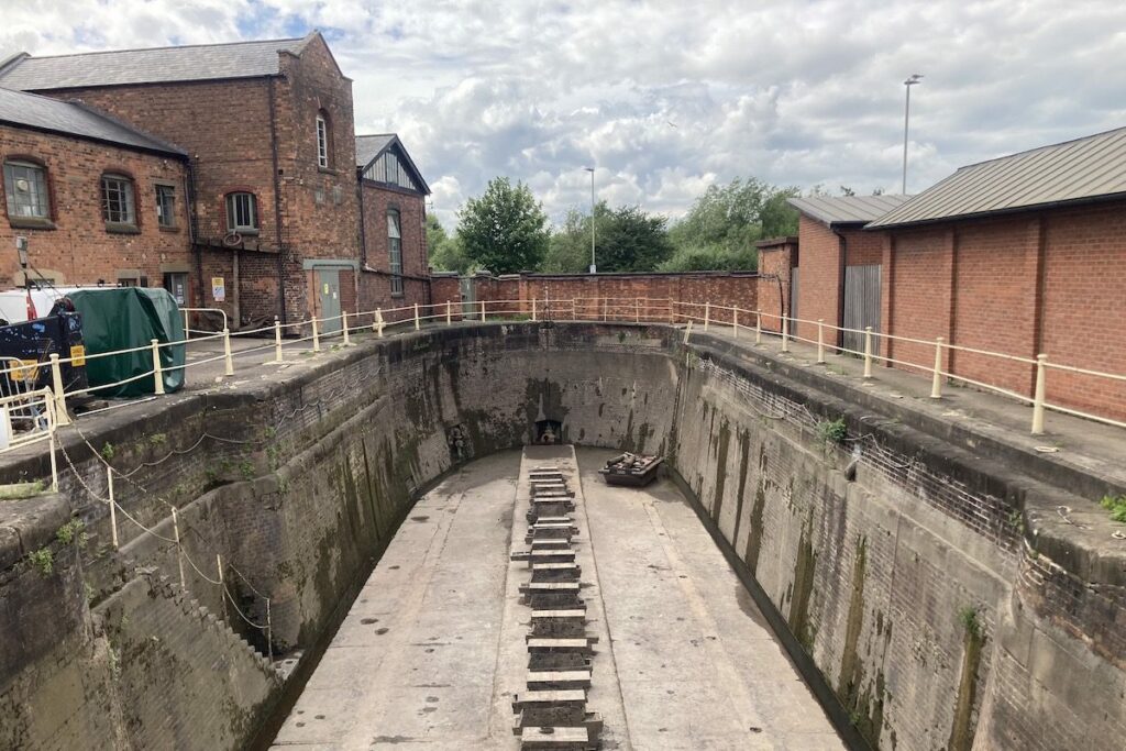
Turn right off Llanthony Road past the old British Waterways sheds and Alexandra Warehouse. As you make your way back to the starting point, take a look at the two graving docks used for ship hull repairs and maintenance. The smallest dock pictured below is the earliest constructed in 1837.
There’s plenty more to see around Gloucester Docks. Unfortunately we could not squeeze it all into this guide. Why not pop into the museums and do a round of shopping whilst you are here?
History of Gloucester Docks
1783 – The idea of constructing a basin and connecting it the River Severn is first proposed but abandoned when the site chosen was included in that of the new county gaol [1].
1793 – An Act of Parliament is obtained authorising the construction of the Gloucester & Berkeley Ship Canal to bypass a meandering section of the estuary that was treacherous to navigate [2]. The idea of a basin is now proposed as a dock where the ship canal will terminate transforming Gloucester into an inland port city.
1794 – Construction begins on the main basin of the docks.
1799 – The main basin is completed; however, work on the Gloucester and Berkeley Ship Canal halts [1].
1811 – The Gloucester & Cheltenham tramroad opens. It ran from Gloucester Docks 9 miles to the limestone quarries at Leckhampton by Cheltenham and was the first railway in Gloucestershire. Wagons carrying goods and minerals were pulled by horses along cast iron plates.
1812 – Gloucester Lock is constructed. It originally consisted of two adjoining locks, which opened the docks to traffic from the River Severn [3].
1814 – A shipbuilding yard opens on the docks.
1817 – Work on the ship canal resumes.
1818 – The first graving dock is opened, constructed by John Bird of Stourport.
1824 – The Barge Arm is completed.
1825 – The Gloucester & Berkeley Ship Canal is completed.
1827 – The ship canal is opened, and the docks start to receive traffic from the Severn Estuary. The North Warehouse is opened by the canal company for letting and to the designs prepared by Bartin Haigh, a Liverpool builder. It is the first warehouse to be constructed on the docks and paves the way for many to be built for private interests [1].
1831 – The office building of the canal company is opened [3] alongside a series of eight warehouses on the western side of the basin for Birmingham corn merchants Joseph and Charles Sturge [1]. They were estimated to have controlled around half of Gloucester’s imported corn at the time [3].
1830 – Biddle Warehouse opens for John Biddle, a wealthy Stroud miller. Its design, prepared by William Franklin of Stroud, included a hipped roof, windows with segmental arches, and loading bays facing both the basin and the barge arm and reflects the style of the Stroud Valley cloth mills. A steam engine is also erected next to the graving dock to top up the dock with water from the river [1 & 3].
1833 – Shiptons Warehouse is opened for James Shipton, a timber merchant [1]. Along with Biddle, the warehouses became the transhipment depot of The Severn and Canal Carrying Company [3].
1834 – Lock Warehouse is opened. The first graving dock is opened to provide the means for ship hull repairs and maintenance [3].
1837 – The graving dock is enlarged to accommodate ships of 700 tons.
1838 – Pillar Warehouse on Bakers Quay is opened. The building projects out over the docks so that the hoist could lift directly out of the ship’s hold without obstructing the quayside.
1840 – Reynolds (originally Sturges) and Vinings Warehouses are completed for the corn merchants of J & C Sturge and Vining & Co.
1841 – Railway sidings are added to the docks by the Birmingham & Gloucester Railway Company, which connected the tramroad and its station on the opposite side of the city [1].
1845 – The customs house building is opened.
1846 – Herbert, Kimberley, and Philpotts Warehouses are opened.
1849 – Increased traffic as duties on foreign goods were reduced necessitated an expansion of the docks and so the Victoria Basin and Victoria Warehouse are opened. The basin was primarily used for moving grain. Later on, the basin was used to export Worcestershire salt. The Weighbridge House is also complete, which starts weighing empty and full carts to determine their weight. The Mariner’s Chapel is opened to provide services for the dockers and foreign mariners who came into Gloucester from all parts of the world.
1850 – City Mills are opened on Commercial Road by the docks, which offers a speedier solution for processing an ever-increasing amount of grain.
1851 – Albert Warehouse is opened.
1853 – The second and larger graving dock is opened. City Mills doubles in size.
1861 – Britannia Warehouse is opened.
1869 – Albert Warehouse is converted into a flour mill.
1870 – Alexandra Warehouse is opened, which originally stored corn, then sugar.
1873 – Llanthony Warehouse, the last great warehouse of the docks is opened
1875 – Alexandra Warehouse is rebuilt after a devastating fire and the original eaves are replaced by a parapet.
1948 – The British Transport Commission takes ownership of the docks following nationalisation of the waterways.
1970s – Small coaster vessels and barges continued to use Gloucester Docks until this decade as British manufacturing declines.
1978 – The customs house becomes the headquarters of the Gloucestershire Regiment.
1979 – Amidst a decline in traffic, some of the warehouses on the docks were repurposed starting with Lock Warehouse, which became an antiques centre.
1980 – The headquarters of the Gloucestershire Regiment is closed, and the former customs house is opened as the Soldiers of Gloucestershire Museum.
1984 – Albert Warehouse became a museum of advertising and packaging.
1986 – The North Warehouse is refurbished and repurposed as the main administrative offices for Gloucester City Council [1].
1987 – Britannia Warehouse is completely rebuilt after it was destroyed by fire [3].
1988 – Llanthony Warehouse opens as the National Waterways Museum Gloucester [1].
 Rockley Engine Tower & Furnace