Galton Valley Trail
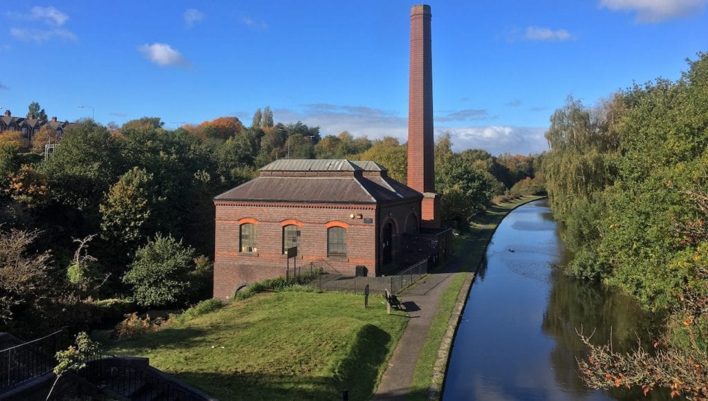
The Galton Valley Trail offers the chance to enjoy five industrial heritage sites situated along the Birmingham Old Main Line and New Main Line canals in Smethwick. It tells the story of how the engineers of the first canal from Birmingham overcame a major obstacle.


Tour guide available
Our tour guide will:
- Lead a walk along this trail
- Advise on transport & required kit
- Highlight key points of interest
- Discuss historical overview
Key info
| Location | Smethwick |
| County | West Midlands |
| Total length | 4.5 miles (7.3 km) |
Trail route
The map below will help you visualise the trail. We have detailed the nearest train stations and the shortest walking route to the canals.
Visiting guide
What are the main points of interest along the trail?
You can start the trail at either end; however, this guide will start from the west side, therefore, the sites are as follows:
- Summit Bridge
- Galton Valley Canal Heritage Centre
- Engine Arm Aqueduct
- Galton Bridge
- Steward Aqueduct
This trail is essentially one big loop walking along the canals. If you are coming in by train, it’s best to start by Bromford Junction on the west end, which is a short walk from Sandwell & Dudley railway station. If you are coming by car, it’s best to start with Galton Valley Pumping Station because of the nearby car park.
Whichever heritage site you choose to start with, walk the entire loop and enjoy the rich industrial history that is present throughout the trail. Walking the trail in autumn is particularly beautiful because the area has plenty of trees that display a lush range of colours.
In the colder months, it’s highly recommended you wear suitable footwear because the towpaths can become quite muddy, especially along the old main line canal.
How long does it take to walk the trail?
The trail will take you at least 2 hours 30 minutes to walk the loop and see all the attractions. If you are planning to walk up the Engine Arm canal and back, add an extra 20 minutes.
We are unable to document the time required to see inside Galton Valley Pumping Station because it remains closed due to the pandemic.
Can you cycle the trail?
Yes, you can; however, the old main line canal towpath is grassy and can become slippy and muddy in winter. Parts of the towpath along this section are quite narrow.
The new main line is much easier to cycle thanks to its tarmac towpath, which is part of National Cycle Route 81. Taking a bicycle will also limit you when it comes to heading up embankments to catch the view from bridges unless you can chain it to railings whilst you venture on foot.
Is the trail suitable for a picnic?
Galton Valley is not the most idyllic location for a picnic although you could get away with one at the bench next to Galton Valley Pumping Station or the Engine Arm Aqueduct. There is a fair amount of greenery and wildlife in the valley; however, you are surrounded by busy roads and a railway line; therefore, sandwiches and a flask of tea may be more suitable than a full-on spread.
What wildlife does the trail offer?
Expect to encounter grey herons, coots, mallards and Canada geese. There are plenty of spots to feed the birds; however, please feed them responsibly.
How do I get to the trail?
There are three railway stations nearby. Sandwell & Dudley is a short walk from the roving bridges at Bromford Junction, Smethwick Galton Bridge is situated next to Galton Bridge and Smethwick Rolfe Street is near the Engine Arm Aqueduct.
If you are coming by car, use the car park on the corner of Great Arthur Street and Brasshouse Lane, there are no restrictions. It’s a short walk to Galton Valley Pumping Station.
History of Galton Valley
Galton Valley is an artificial landscape that was dug out by hand to create a route for the Birmingham Canal Navigations (BCN) Main Line. Its story starts with the birth of canals in the local area.
1769 – The very first canal in Birmingham was completed. The initial line went from two wharves in Birmingham to the coalfields near Wednesbury and West Bromwich.
The surveyed route involved the canal crossing a hill at Smethwick. The engineer James Brindley encountered ‘running sand and other bad materials’ and so he decided not to tunnel through the hill [1]. Instead, six locks were built to raise the canal from the Birmingham level at 453 ft (138 m) to the 491 ft (150 m) summit level before descending via three more locks to the Wolverhampton level at 473 ft (144 m) and another three locks back down to 453 ft by Spon Lane near West Bromwich.
Supplying a series of canal locks with water is always a challenge. Water from the top is transferred down when boats pass through and so requires filling up to work again. In this instance, the Smethwick summit requires a lot of water because it’s a short stretch of raised canal with locks at either end.
Brindley originally supplied the summit with water from the Smethwick Great Reservoir, which was constructed in 1769 by damming Thimblemill Brook [2]. An additional feeder was built that connected the nearby pool at Smethwick Hall to the Great Reservoir [3].
1772 – The route was then extended to Wolverhampton where it met the Staffordshire and Worcestershire Canal that linked up to the rivers Trent, Mersey, and Severn.
1774 – Another reservoir called Titford Pool was completed to collect rainwater from the nearby Rowley Hills as an additional supply delivered via a narrow feeder [4].
Not long after the canal opened, it became apparent that all the reservoirs could not adequately supply the Smethwick summit. The Great Reservoir held 1,514 lockfuls of water, the pool at Smethwick Hall held 100 lockfuls and Titford held 500, a total of three weeks supply [5].
The immediate success of the canal resulted in much more traffic passing through than what was originally expected. It was also reported that the Smethwick Great Reservoir leaked.
1777 – A large Boulton and Watt steam engine was erected by the locks at Spon Lane to the west to pump water from the Wolverhampton level (473 ft) back up three locks to the summit (491ft).
1778 – Another engine was erected near the Smethwick locks in the east except it was more powerful because it had to pump water from the lower Birmingham level (453 ft) back up six locks to the summit [6].
1786-1789 – As Birmingham and the surrounding areas started to increase their manufacturing output, traffic on the canal increased and the locks at Smethwick still presented a time-consuming obstacle. The canal network also expanded to Walsall and Coventry, which resulted in additional strain on the already inadequate water supply. All of this cast doubt on the canals ability to expand its capacity.
1790 – A solution was completed according to the design of John Smeaton. A cutting was constructed, which reduced the height of the hill and the canal from 491 ft to 473 ft. The three locks at Spon Lane, which lowered the canal to the Wolverhampton level, were removed and so was the adjacent steam engine. The six locks at Smethwick were halved to three; however, the engine (now dubbed the ‘Smethwick Engine’), was relocated closer to the canal and continued to operate [6]. This is how Galton Valley started to take shape.
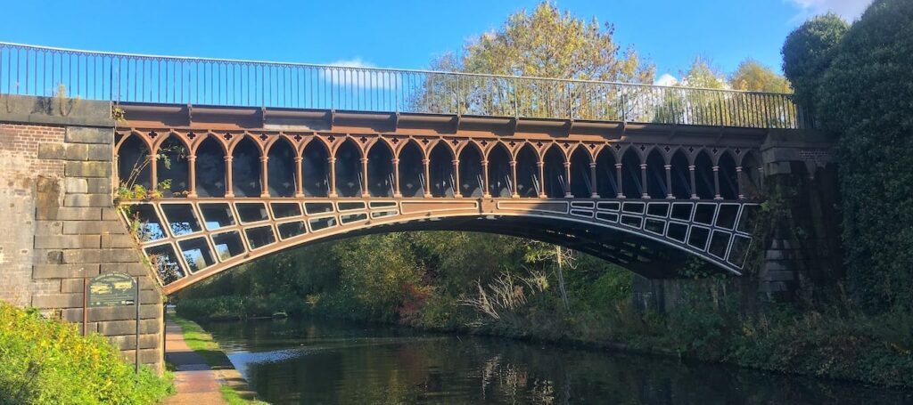
Smeaton’s improvements also involved the construction of the Summit Bridge to carry Roebuck Lane across the new cutting and a duplicate flight of locks running parallel to Brindley’s locks at the eastern end of the summit to ease congestion further. After Smeaton’s improvements, the canal got busier and busier. It became evident that the locks at Smethwick still formed a bottleneck that restricted the flow of traffic.
1824-1829 – Engineer Thomas Telford provided a solution by widening parts of the existing BCN Main Line and bypassing time-consuming sections.
For the new line to bypass the locks at Smethwick, another deep cutting was required. The cutting is where the new canal runs at a level of 453 ft parallel to the Old Main Line above at 473 ft. This diagram details the different levels of Galton Valley as you would see it today.

The cutting is 2.3 miles long (3.68 km). The resident engineer for carrying out this work was William Mackenzie, the contractor was T. Townshend [7].
After the cutting was complete, Galton Bridge was built by Telford in 1829 near the Summit Bridge to continue carrying Roebuck Lane over the valley. The existence of these two bridges made from contrasting materials and constructed in two different periods of the canal age gives Galton Valley a unique charm.
Telford’s improvements left the Smethwick locks intact and navigable. This meant a supply of water was still required for the locks to remain operational. Telford provided a solution in 1826 by constructing the Edgbaston Reservoir and a new feeder that linked up to the existing Engine Arm canal, which he extended. The magnificent Engine Arm Aqueduct was then constructed to carry the canal over the BCN New Main Line.
1840s – The Smethwick Great Reservoir was used until the mid-1840s before its water was redirected into the feeder from Titford Pool to Edgbaston Reservoir.
1857 – Thimblemill Brook reverted to its original course and the great reservoir was drained [4]. Housing occupies the site today.
1892 – Galton Valley Pumping Station replaced the Smethwick Engine, which carried on operating until the previous year when it was deemed irreparable.
1946 – All equipment is removed from Galton Valley Pumping Station and the building falls into disrepair.
2000 – The pumping station has been listed and is now completely restored after a 22 year project. It now functions as part of the Galton Valley Canal Heritage Centre and is open to visitors.
Canal feeder system
Here is a map that documents the entire Smethwick summit canal feeder system. Red lines are culverts that are either demolished or no longer used. Green lines are culverts that are still in use to this day.
Sources
- Hadfield, C. (1985) The Canals of the West Midlands. Newton Abbot: David & Charles (Publishers) Limited.
- Baggs, A. P. et al. (1976) ‘Smethwick: Communications’, A History of the County of Stafford: Volume 17, Offlow Hundred (Part), pp. 96-98. Ed. Greenslade, M. W. Available at: http://www.british-history.ac.uk/vch/staffs/vol17/pp96-98 (Accessed: 6 December 2020).
- Dean, R. (2008) Canals of Birmingham and the Black Country, No. 2 in the Historical Canal Maps series. Third Edition. The Historical Canal Map series. Stoke on Trent: Cartographics.
- Weaver, P. (1986) ‘Some Interesting Data on the Birmingham Canal Navigations’, Journal of the Railway and Canal Historical Society, 28(7), pp. 278-303. DOI: ISSN 0033 8834.
- Broadbridge, S. R. (1974) The Birmingham Canal Navigations Volume I 1768-1846. Newton Abbot: David & Charles (Holdings) Limited.
- C. P. and C. R. Weaver (1970) ‘The Smethwick Pumping Engines’, Journal of the Railway and Canal Historical Society, 24(3), pp. 57-61.
- Cragg, R. (1997) Civil Engineering Heritage Wales and West Central England. London: Thomas Telford Publishing.

 Summit Bridge Smethwick