Elan Valley Aqueduct
The Elan Valley Aqueduct carries drinking water 73 miles from the Elan Valley to Birmingham. Although the vast majority of the aqueduct is underground, there are many visible landmarks, which can be used as markers for picturesque walking routes. We detail two routes that will give you a glimpse into the sheer scale of this vital piece of infrastructure.
Key info
| Counties | Powys & Shropshire |
| Original year of completion | 1904 |
| Original engineer | James Mansergh |
| Maintained by | Dŵr Cymru Welsh Water & Severn Trent Water |
Visiting guide
There are many visible landmarks that you can see along the route of the Elan Valley Aqueduct, which would take a considerable amount of time to visit. For convenience, we have detailed two walking trails so you can see enough to appreciate the magnitude of this engineering masterpiece. We also have a guide for visiting the Elan Valley dams and reservoirs.
How long does it take to walk the trails?
It takes the following times to walk each trail:
- Bringewood trail – 1 hr 10 mins
- Severn trail – 50 min
Is the Elan Valley Aqueduct suitable for a picnic?
The Elan Valley Aqueduct travels through the beautiful Welsh and English countryside, which offers multiple scenic spots for a picnic. Our favourite spot would have to be north of the Deepwood Dingle Crossing next to the stream on the Bringewood trail.
Trails
Ready to explore? Let’s begin!
Bringewood Trail
This circular trail follows the Elan Valley Aqueduct through Bringewood, a woodland on high ground with stunning views of the Shropshire countryside.
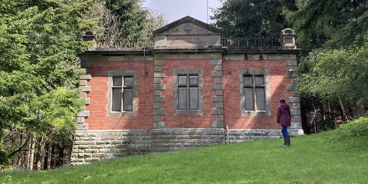
Start off from the car park on Middle Wood Road. Head west and follow the footpath after the road bends to the right. Keep going until you reach where the path s-bends, you’ll see a route to the left that goes uphill into the forest diagonally. This will take you to the fist valve house at the top, notice the engraved pediment on the roof.
Walk along the route of the aqueduct, which is marked by the linear clearing through the woods. The varying inclines of the terrain will test your fitness. You will then cross a dirt track where you can see the next valve house at the top of the incline.
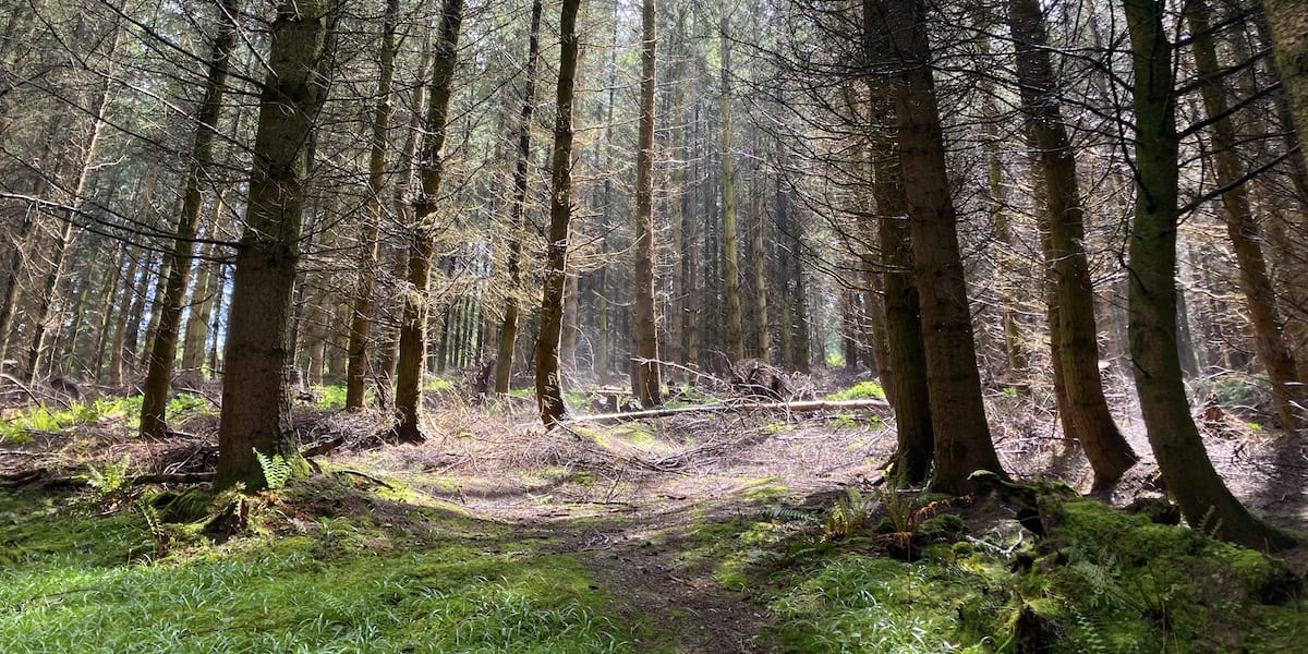
You will now venture through the wood, and if you visit after it has rained, you’ll be lucky enough to see water vapour rising from the ground where the sun is shining. It creates a hauntingly serene environment.
Head along the path and you will see where the aqueduct crosses Deepwood Dingle ahead. You cannot walk across so follow the path to the right.

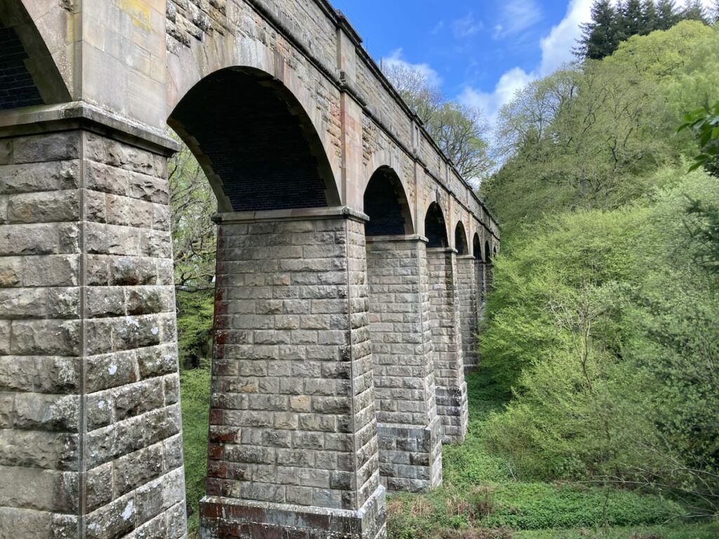
Head downwards then take a left where the path bends. This route will take you under the aqueduct, where you can get a fine view of its arches. This structure is between 80 and 90 ft (24.4 and 27.4 m) high and was constructed by Messrs. Morrison & Mason of Glasgow [2]. In this instance, we climbed the side of the dingle to photo the aqueduct from the west.
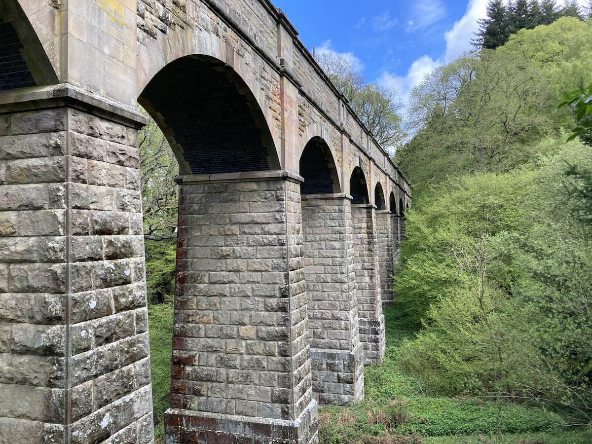
Head through the gate and follow the stream. If you walk this trail in April or early May, we highly recommend you cross the stream and climb the hill covered with trees and bluebells. Walk up the hill back towards the aqueduct and you will see get one of the best views of this attraction with a carpet of bluebells in the foreground.
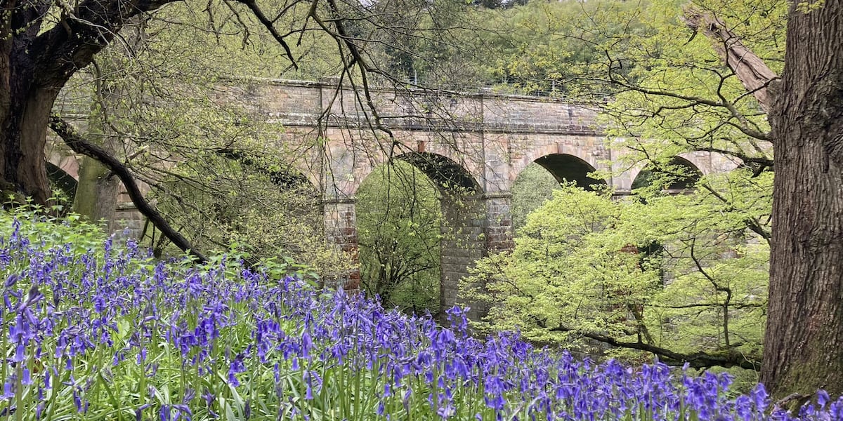
Head back down the hill, cross the stream again and follow it down to a gate, which will take you back onto Middle Wood Road. Walk west on the road back to the car park where you started.
How do I get to the Brindwood Trail?
This trail is quite isolated so it’s best to travel by car or get a taxi from Ludlow, which is the nearest town. There is a car park at the northeast corner of Bringewood where the trail starts on Middle Wood Road, which is a narrow lane so take care when driving along.
Severn Trail
This trail follows the Severn Valley Railway along the River Severn. You will see Trimpley Reservoir, the Elan Valley Aqueduct crossing the Severn, and if you’re timely, a selection of historic steam or diesel trains.
Start off from the Eymore Wood car park. Head towards the entrance road to Trimpley waterworks, there is a gate to the left with a path that leads down to the railway. You will reach a pedestrian crossing, please be careful. Stop, look, and listen for approaching trains.
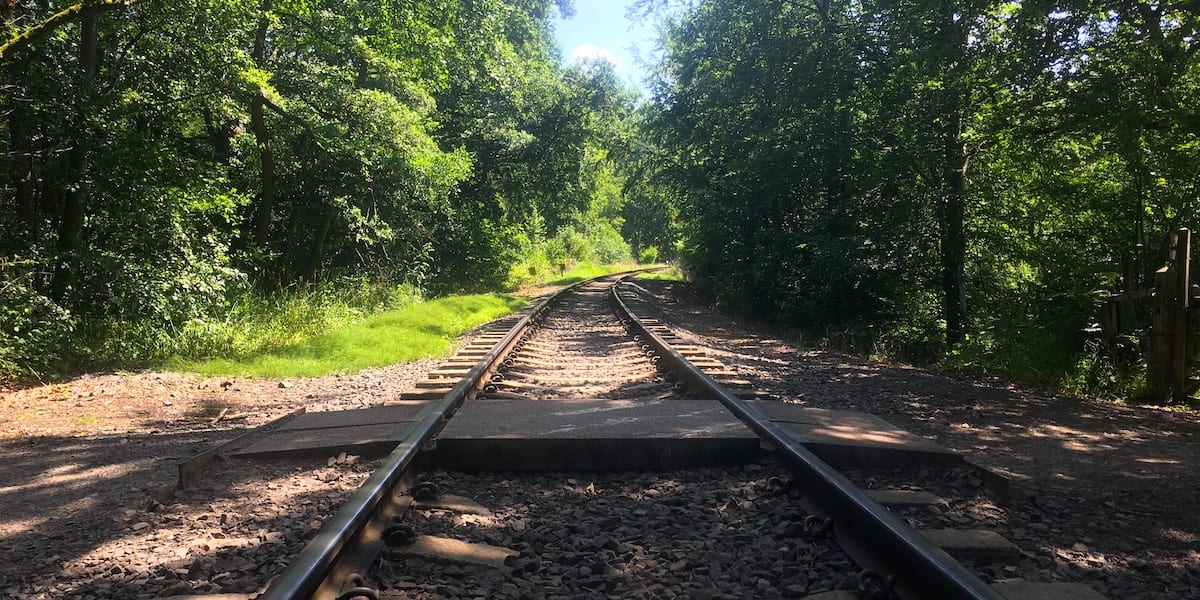
You will now see the lower pool of Trimpley Reservoir in front. Follow the path round to the left, you’ll then see a fork with the left path leading down to the Severn Way. This public footpath follows the river, and you are going to walk downstream. Follow the winding path along the river and you will eventually arrive where the Elan Valley Aqueduct crosses the Severn. This is the largest visible structure of the aqueduct and is quite impressive.

At the side of the fence are some steps that lead down to the riverbank. This is where you will get a good view of the cast iron arch that spans the river. Look closely and you can see the pipes above.
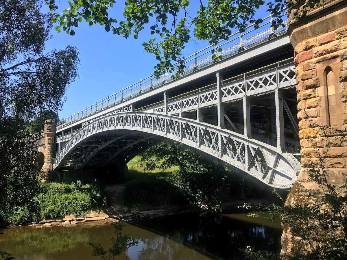
In the distance, you’ll see the stone arches along the Severn floodplain. Notice the lancet window that is present in the stone pillar of the abutment. A delightful feature that transforms the pillar into a castle turret.
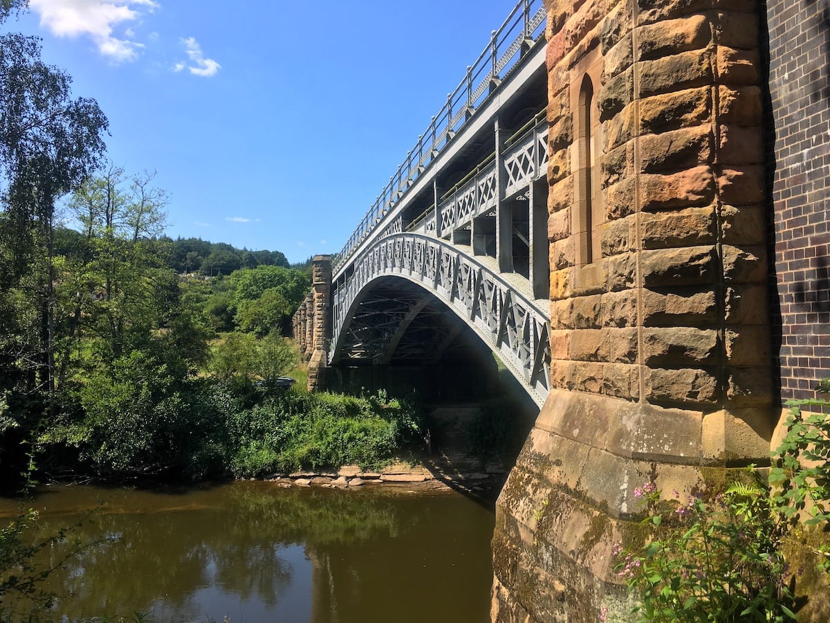
Head back up the steps to the Severn Way. You now have the option to continue downstream, or you can walk back and explore more of Trimpley Reservoir. You may be lucky enough to spot some vintage rolling stock as you cross Severn Valley Railway on your return journey.
How do I get to the Severn Trail?
This trail is also quite isolated so it’s best to take a car. You could also catch the Severn Valley Railway and request a stop at Northwood Halt, then walk 10 minutes up Northwood Lane to the aqueduct crossing the river, this would essentially present the trail in reverse order.
History of the Elan Valley Aqueduct
1892 – Parliament passes a Bill that approves the Birmingham Corporation’s plan to construct a series of dams and reservoirs in the Elan Valley to provide a clean supply of drinking water for the City of Birmingham [1].
1893 – Work on the dams and reservoirs begin.
1896 – Work on the first section of the aqueduct to Dolau begins [1]. The constructions above ground are few so as not to disfigure the countryside [2].
1898 – The second section of the aqueduct to Knighton is complete [1].
1904 – The first series of Elan Valley dams and reservoirs, the aqueduct, and Frankley Reservoir are completed, and the water supply is officially opened by King Edward VII and Queen Alexandria [1]. The aqueduct only uses two mains to begin with.
1939 – A third main is installed increasing the capacity of the aqueduct to about 55.5 million gallons a day [3].
1952 – Claerwen dam and reservoir are completed doubling the supply of water to Birmingham.
1961 – A fourth main is installed increasing the capacity of the aqueduct to about 75 million gallons a day [3].
1968 – Trimpley Reservoir is completed. It was constructed to supplement the Elan Valley Aqueduct using treated water pumped from the River Severn [4].
2015 – Work starts on the first of three bypass tunnels at Bleddfa. These tunnels measuring 3.05 m in diameter are required to divert water from key sections of the Elan Valley Aqueduct that require more frequent maintenance and refurbishment due to their age. Bypassing the water enables engineers to enter the Aqueduct without shutting it down entirely. The work is part of a £300M flagship scheme called the Birmingham Resilience Project, which also involves creating a new supply from the River Severn at Lickhill near Stourport. This new supply will serve as a backup, which will allow the Elan Valley Aqueduct to be shut down for longer periods of time without interrupting the supply of water to customers [5].
2017 – The first bypass tunnel at Bleddfa is completed and becomes operational. It took six months for the tunnel boring machine to dig 1.1 miles (1.8 km) [5]. The second bypass tunnel at Nantmel measuring 0.6 miles (1 km) is completed shortly after. The sites used a reinforced soil wall to create a flat platform for launching the tunnel boring machine in an open cut excavation [6].
2020 – The last bypass tunnel at Frydd Wood near the town of Knighton is completed. The new 1.1 miles (1.8 km) tunnel runs under Offa’s Dyke and included the construction of a new well house that is connected to the existing siphon [6].
Technical info
How long is the Elan Valley Aqueduct?
The Elan Valley Aqueduct is 73 miles (117.5 km) in length running from the Elan Valley near Rhayader in Wales to Birmingham in the West Midlands [3].
What is the difference in elevation?
The Foel Tower at the start of the Elan Valley Aqueduct is 171 ft (52.1 m) above Frankley Reservoir in Birmingham [3].
How fast does water travel down the aqueduct?
Water travels at approximately 2 miles per hour. It takes two and a half days to arrive in the Frankley Reservoir from the Elan Valley and it is all done under gravity with zero pumping [3].
How much of the Elan Valley Aqueduct is underground?
The vast majority of the Elan Valley Aqueduct is buried underground with some sections up to 200 m below ground. The aqueduct uses siphons constructed as pipelines across larger valleys and two types of conduits, that is tunnels, and cut and cover, where the engineers dug down to create the conduit and then covered the top with bricks and earth [3]. The Elan Valley Aqueduct is 50% conduit and 50% siphon [7].
The internal dimensions of the conduits are approximately 8 ft (2.4m) high and 7.5 ft (2.3 m) wide in a horseshoe shape. They are lined throughout with concrete and faced internally on the side and invert with blue engineering bricks [3].
The aqueduct uses pipes when crossing roads, rivers, streams, and gorges.
How many mains does the Elan Valley Aqueduct contain?
The Elan Valley Aqueduct opened with two independent mains measuring 42 inches (1.07 m) in diameter, the idea being that if one failed, the aqueduct would function at 50% capacity [3]. Space was left for four more mains of the same diameter indicating the engineers were leaving space for expanding the supply as Birmingham grew [1].
The space of the four additional mains ended up being used by two 60-inch (1.5 m) diameter pipes, one installed in 1939 and the other in 1961. The original mains were also strengthened with concrete to minimise failures where the pressure was high. This extension increased the capacity of the aqueduct to 75 million gallons, equivalent to the approximate yield of the Elan Valley works [3].
Sources
- Brown, D. L. (2020) The Elan Valley Clearance. Eardisley: Logaston Press.
- Mansergh, J. (1901) The Birmingham Waterworks, Lecture at International Engineering Congress. Available at: https://www.ebooksread.com/authors-eng/international-engineering-congress-1901–glasgow/report-of-the-proceedings-and-abstracts-of-the-papers-read-hci/page-23-report-of-the-proceedings-and-abstracts-of-the-papers-read-hci.shtml (Accessed: 19 July 2021).
- Morton, R. (1997) The Building of the Elan Valley Dams. Walsall: Brian Lowndes Print Limited.
- Severn Trent Water (2020) Trimpley Reservoir. Available at: https://www.stwater.co.uk/wonderful-on-tap/our-visitor-sites/come-visit-us/trimpley-reservoir/ (Accessed: 19 July 2021).
- Severn Trent Water (2020) We’ve completed the first of three Elan Valley Aqueduct bypass tunnels. Available at: https://www.stwater.co.uk/news/news-releases/wevecompletedthefirstofthreeevabypasstunnels/ (Accessed: 19 July 2021).
- Severn Trent Water, BNM Alliance and GHD (2018) Birmingham Resilience Project – Elan Valley Aqueduct (Nantmel and Frydd Wood) (2018). Available at: https://waterprojectsonline.com/custom_case_study/elan-valley-aqueduct-2/ (Accessed: 19 July 2021).
- Bourke, F. (2015) ‘See our underground tour of the Elan Valley Aqueduct in Wales which has kept Birmingham taps running for over a century’, Birmingham Mail. Available at: https://www.birminghammail.co.uk/news/midlands-news/see-underground-tour-elan-valley-10361980 (Accessed: 19 July 2021).

 Over Bridge